|
|
WAIOTAPU WONDERLAND
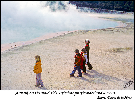
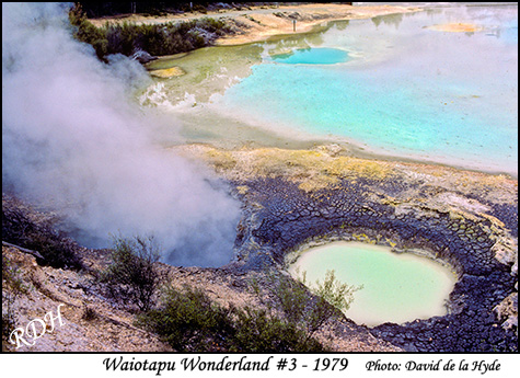
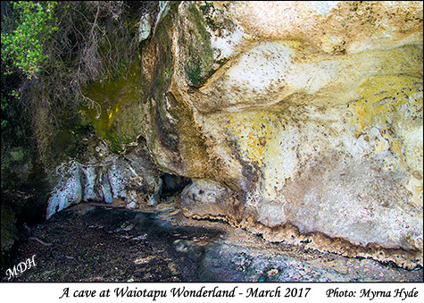
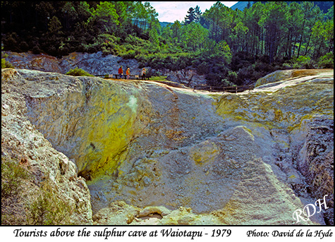
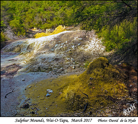
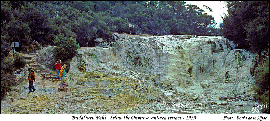
Since geography lessons in High School I have always been fascinated by New Zealand's Volcanic Plateau. I visited Wai-O-Tapu in 1979 and took some colour slides of which I have included a few here for comparisons. In particular I like the ranges of colour seen in geothermal springs such as can be seen at the Waiotapu Wonderland site.
The chemical make up of the colors is as follows:
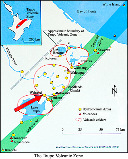
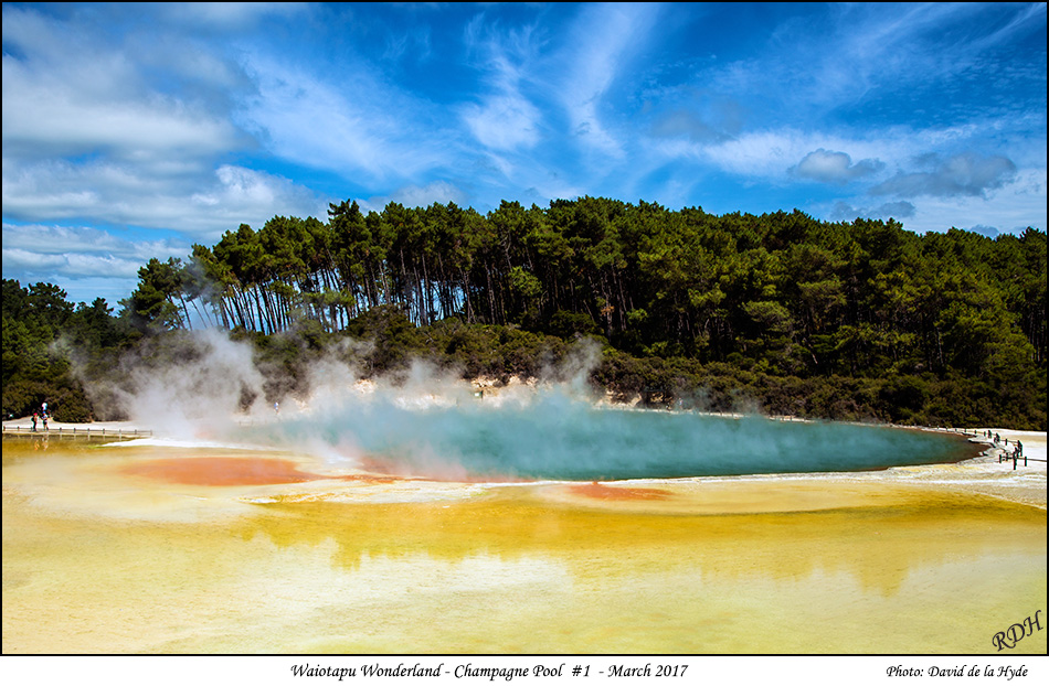
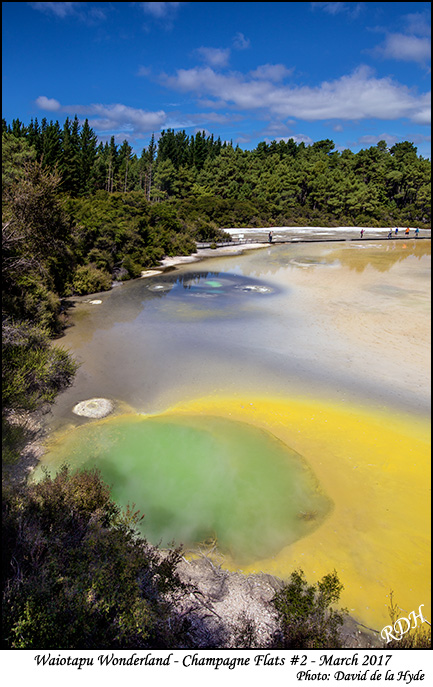
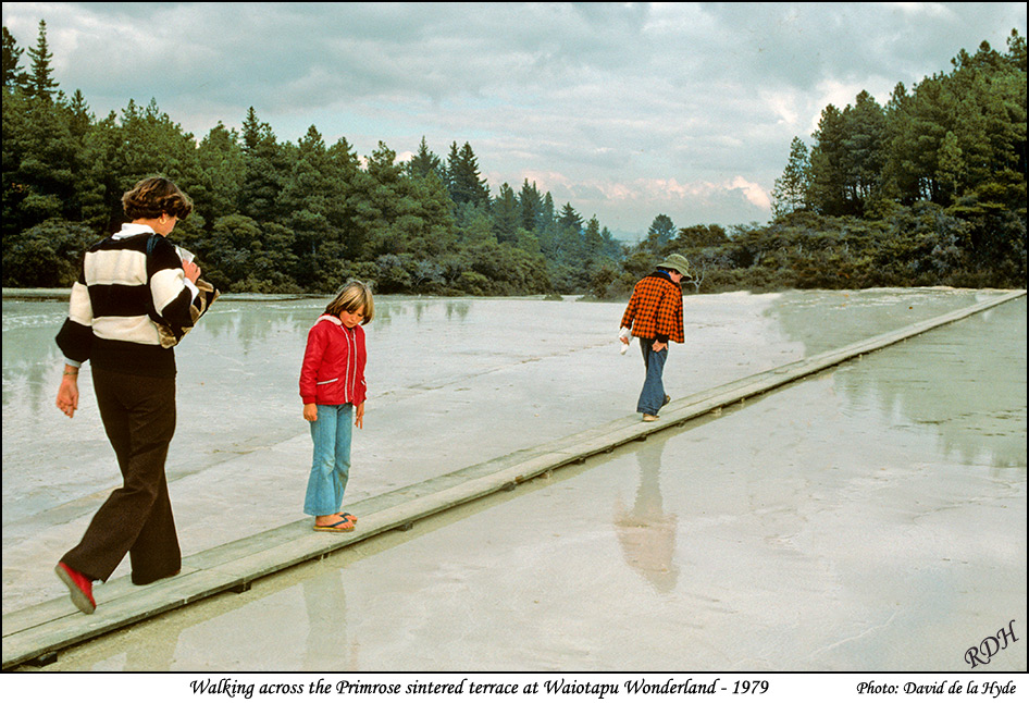
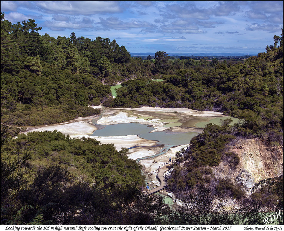
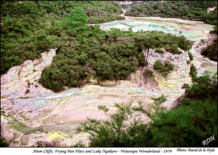
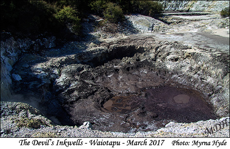
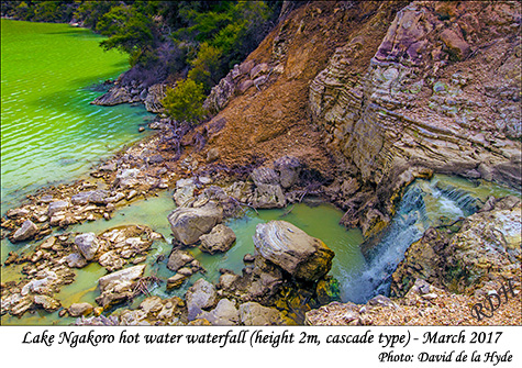
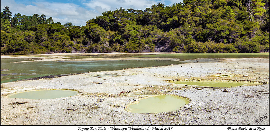
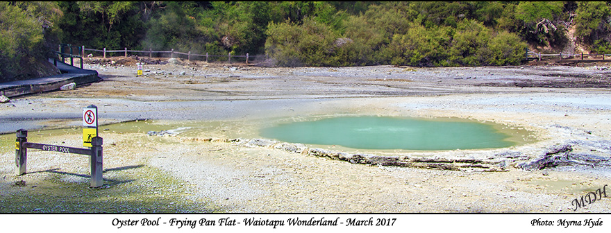
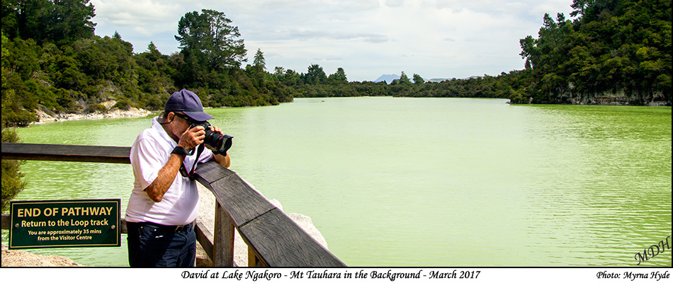
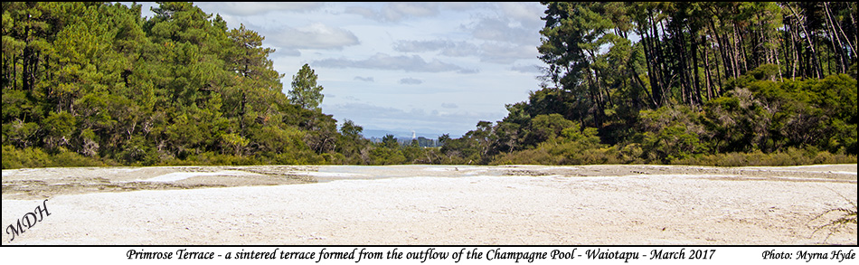
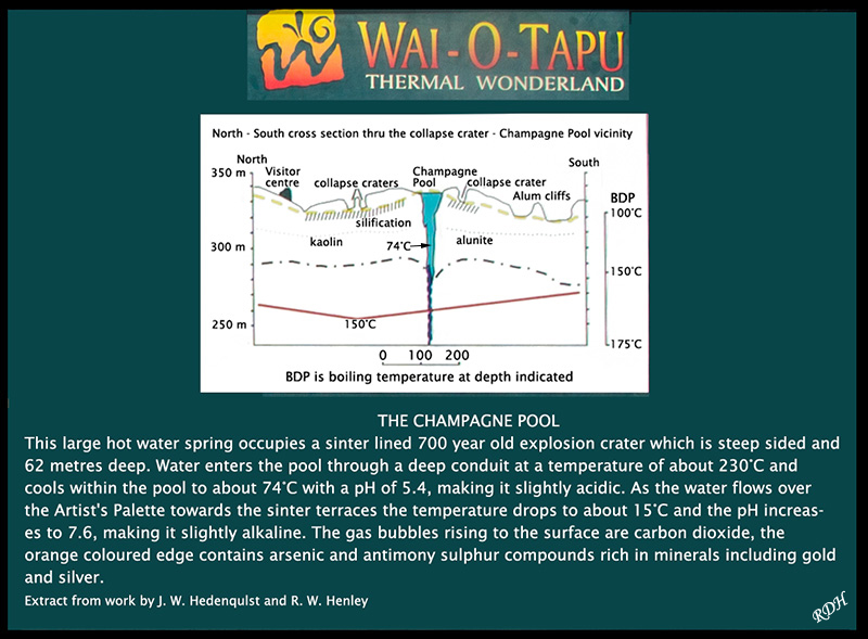
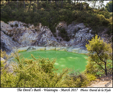
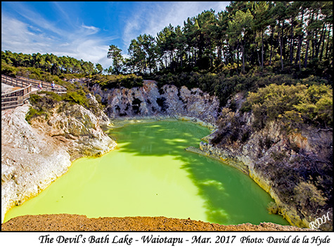
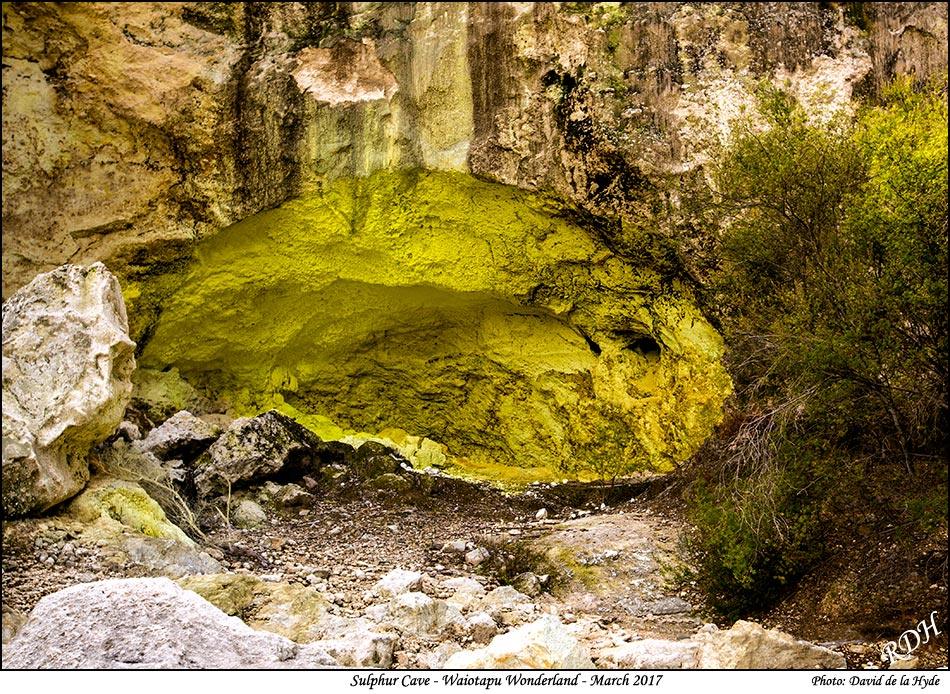
The 65m wide and 60m deep Champagne Pool was formed over 700 years ago by a hydrothermal eruption. Silica deposits emplaced by water overflowing from the pool have formed the 1.5 hectare primrose sinter terraces. Wai-O-Tapu is located on the northern perimeter of the Reporoa caldera. This caldera is approximately 10x15 km in size and was formed 230000 years ago during a massive eruption which emplaced 100 cubic kilometers of breccia (ash and pumice) referred to as the Kaingaroa Ignimbrites. These are over 30m thick in places. Around the time of the Kaharoa eruption of nearby Tarawera (800 years ago) a number of large hydrothermal eruptions occurred in Wai-O-Tapu. Drill holes at Wai-O-Tapu show that the current source of heat is located under the northern margin of Reporoa and the southern part of Wai-O-Tapu. Reference: Wai-O-Tapu Geothermal Area (http://www.photovolcanica.corn/VolcanoInfo/Wai-0-Tapu/Wai-0-Tapu.html) THE CRATERS: Well over a dozen craters are located in close proximity. They range from 5-50 meters in diameter and are up to 20 meters deep. All were formed by the ground surface collapsing. The most recent collapse was Thunder Crater in 1968. Many craters have various types of geothermal activity including steam fumeroles, sulphur vents and bubbling pools. THE TAUPO VOLCANIC ZONEThe Taupo Volcanic Zone is generally recognised as one of the most active volcanic areas in the world. About 250 kms in length and 30 kms - 80 kms wide, the zone follows a North Easterly direction. It is anchored to the South by the volcanoes Tongariro, Ngauruhoe and Ruapehu. At the northern end is White Island an active volcano 48 kms off the Bay of Plenty coast. Within the zone are 17 major hydrothermal fields, 2 of which contribute about 5% of New Zealand's total power supply. One of them, Ohaaki, is visible on a clear day from No.11 on the guide map. Wai-O-Tapu is right on the edge of one of 4 volcanic calderas within the zone. With the discovery of the sinter terrace forming from the Champagne Pool and the destruction of the Pink and White terraces in the eruption of Mt. Tarawera In 1886, Wai-O-Tapu became known as "The New Wonderland". Wai-O-Tapu Thermal Wonderland is the most active area associated with the surface of the larger Wai-O-Tapu Geothermal Field. (From a poster at Waiotapu) |
|
|
|
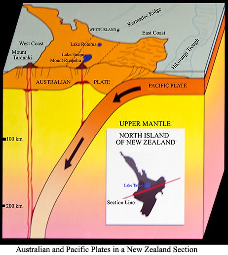
THE SHAKY ISLESMaori legend tells how Maui used the Jawbone of his ancestor baited with blood from his nose as a fish hook to pull up the North Island. New Zealand literally did rise from the sea millions of years ago when It was part of the landmass of the southern hemisphere known as Gondwana. The earth's crust is made up of a patchwork of interlocking slabs (plates) which move independently like enormous ice flows. Today New Zealand straddles the boundary between the Indian - Australian and Pacific Plates. Tremendous natural energy is released which results in many spectacular geological occurrences including mountain building, earthquakes and volcanic activity. In the last 150 years, earthquakes In Wellington (1855), Murchlnson (1929), Napier (1931), Edgecumbe (1987) and Christchurch (2010) have resulted in marked land changes confirming New Zealand as "The Shaky Isles". (The above from a poster at Waiotapu) Andesite rock: is an extrusive rock, intermediate in composition between rhyolite and basalt. The word Andesite is derived from the Andes Mountains in South America, where Andesite is common. Andesite is variable in colour, but typically is bluish-grey or grey (lighter coloured than basalt). Andesite Rock can be used as aggregate fill, and is used in the construction and roading industries.
New Zealand occurrences of Andesite are: West Auckland (Waitakere Range), Coromandel
Peninsula. Great and Little Barrier Islands, Western Bay of Plenty (Kaimai Range),
Raglan-Kawhia area (Karioi, Pirongia), Taranaki, Central North Island (Ruapehu, Tongariro,
Ngauruhoe)
|
|
|
|
|
|
|
|
|
|
|
|
|
|
|
|
|
|
|
|
|
|
|
|
|
|
|
|
|
|
|
|
|