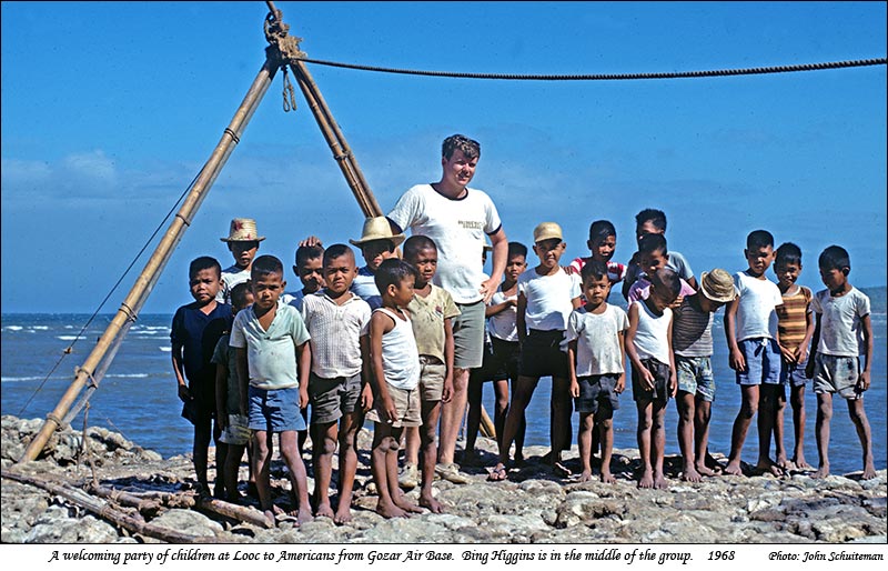
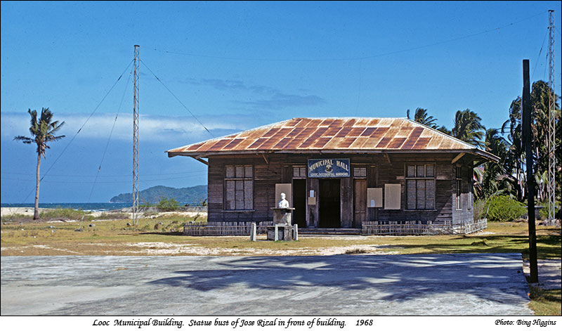
Note - Oct. 2014: Bing Higgins, who was posted to Gozar Air Station in 1968 by the USAF, sent me two photos taken in Looc which I have included at the bottom of this page.
|
|
A TRIP FROM TILIK TO LOOC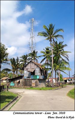
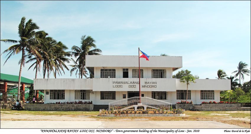
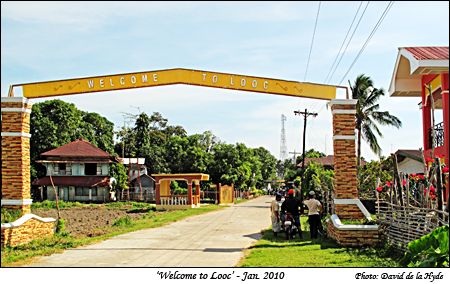
On the second visit to Lubang Island (Jan. 2010) one objective I had was to go by road to Looc. Fortunately, the local Barangay Captain of Tagbac (Arnel De Lara) learned of my intentions, and he offered to take me there by motorcycle. Otherwise I might not have made it. Thus with myself and Arnel De Lara on one bike, and Myrna with a nephew on another, we set off one day from Kusang Loob to Looc. This page is based on the section of the main road between Tilik and Looc as I have partly covered the rest on other pages on this site. Once some distance past Looc I could see (and feel) that the choice of motorbike transport was a good one. The road is in poor condition in many places and is probably one of the main factors inhibiting the development of the Municipality of Looc. The main centre of Looc appears to have got its name from a local dialect's word for bay 'look'. The wide bay is used by boats as a refuge in bad weather from storms, even during the early Spanish period. Obviously I could not pick up an extensive amount of information about Looc in a one day trip, but the Municipality of Looc has generously prepared some attractive material (includes history, photos and statistics) which is included in the pdf file below: Municipality of Looc file (431 Kb) An intensive source on the history of Looc is the following: Reference: HISTORY OF LOOC by Rudy Candelario - translated into English by Benjamin Walata. (http://occidentalmindorohistory.googlepages.com/historylooc) |
Note - Oct. 2014: Bing Higgins, who was posted to Gozar Air Station in 1968 by the USAF, sent me two photos taken in Looc which I have included at the bottom of this page. |
|
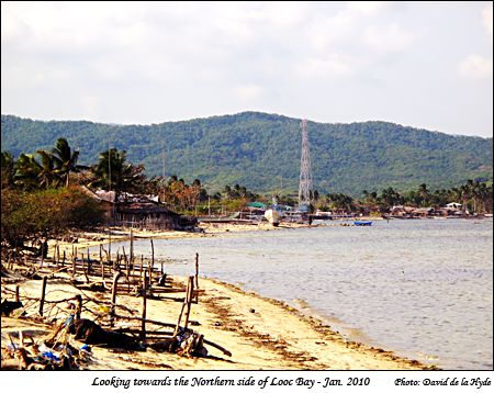
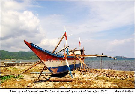
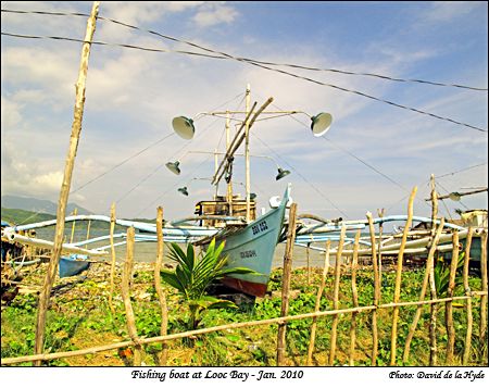
In this photo both the aerial in the photo on the top left and the boat on the immediate left can be seen in the centre. |
|
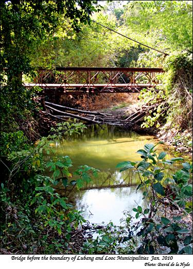
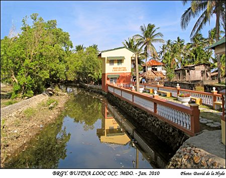
In severe storms the bridge at the left can become impassable due to flood waters. Logs can be seen under it which have been carried down the river in flood times. |
|
|
|
|
|
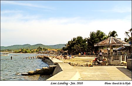
Close to the town centre the water is not very deep and apparently passengers on pump boats may have to disembark and wade ashore. From the photo small dinghies could reach the steps at high tide. |
|
|
|
|
|
|
|
|
|
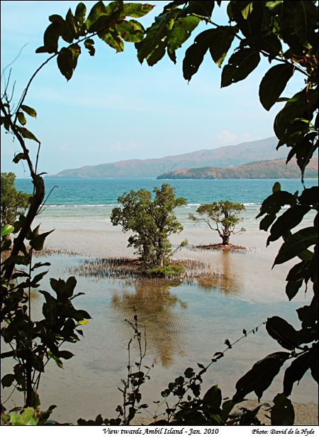
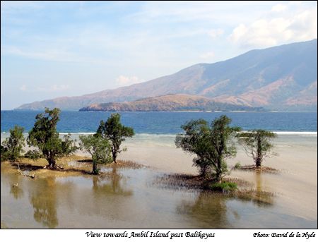
The background hills are those on the the northern side of Looc Bay. |
|
|
|
|
|
|
|